
Quick Links: Bald Ledge, Devils Den, Giovanella Family Forest, Fox Brook, Herons’ Haven, The Great Porter Heath, Moody Road, Norton Hill, Acquisition History
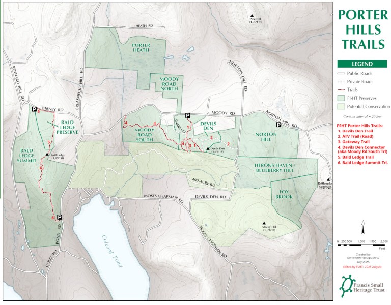
At the start of 2025, our FSHT-owned Porter Hills properties comprised ten parcels, as shown on the Project Map and described below. Altogether, these FSHT properties total approximately 825 acres. All these lands are open for public access for low-impact uses. Details of trails, access roads, and allowed uses are in the Trails & Maps articles. The Project Map also shows other lands protected from development by conservation easements, but some private lands may not allow public access.
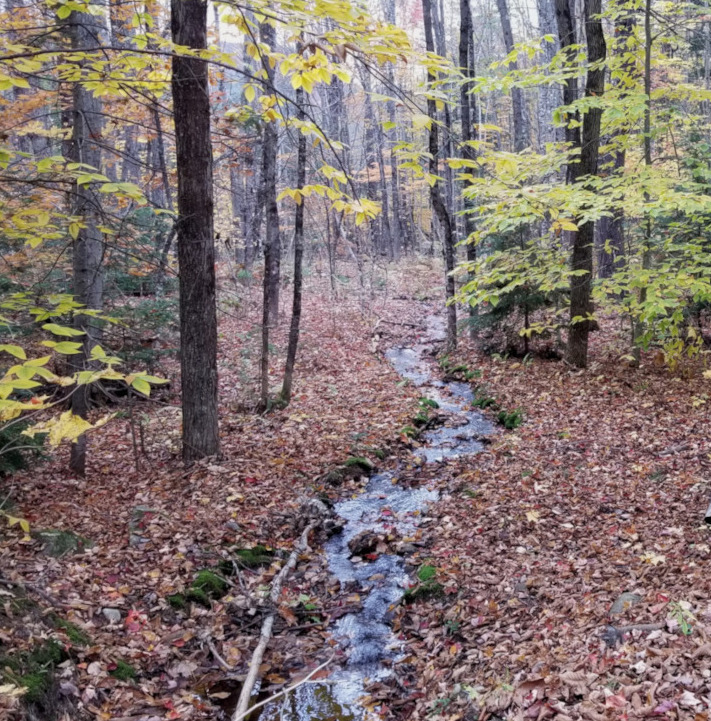
The Porter Hills region is a rippled land of forested hills and valleys with wetlands, streams, and water bodies. Some high hilltops support an Ironwood-Oak-Ash* woodland; on other high slopes, we find Pine-Oak* forest stands. In many low areas, we have significant wetlands and some possible vernal pools. Several high outcroppings on these properties have spectacular views, and our Porter Hills Initiative has secured ownership of many of these features, assuring public access and the maintenance of fragile ecosystems for the future. The Maine Natural Areas Program (MNAP) has designated 6000 acres of the Porter Hills as one of the Focus Areas having high priority for conservation and habitat protection. Across the entire state, there are about one hundred Focus Areas of Statewide Ecological Significance, and this area is one of those. The MNAP has identified habitats here for numerous species of rare plants; as our conservation, maintenance, and trail work continues, we will be looking here for other rare plants and significant ecosystems.
*MNAP has identified numerous types of forested and woodland natural communities, including these two. See: https://www.maine.gov/dacf/mnap/features/community.htm
Public Access on FSHT Lands in Porter Hills:
- Allowed: Hiking, snowshoeing, hunting, and other low-impact uses.
- Legal hunting permitted.
- Motor vehicles are restricted to designated roads, trails, and maintenance purposes.
- Managed forestry with a focus on carbon sequestration.
- “Forever wild” areas with limited forest management to control invasive species and repair damages though some forest management is allowed to reduce invasive species or to repair damages and remove risky conditions like hazardous trees.
FSHT Porter Hills Parcels in the order of our acquisitions:
- 2010 Bald Ledge (26.5 acres) acquired from the National Audubon Society
- 2022 Porter Heath (133.4 ac.) acquired with the support of an MNRCP grant
- 2022 Bald Ledge Summit (198.8 ac.) acquired as a gift of the Giovanella family
- 2022 Giovanella Family Preserve (166.9 ac.) was also acquired as a gift from the family.
- 2023 Herons Haven (21.6 ac.) was acquired with the support of an LMF grant.
- 2023 Blueberry Hill (63.7 ac.) was acquired with the support of an LMF grant.
- 2023 Devils Den (46.3 ac.) acquired with the support of an LMF grant.
- 2023 Fox Brook (69.4 ac.) was acquired with the support of an LMF grant.
- 2024 Moody Road North (30.8 ac.) was acquired with the support of an LMF grant.
- 2024 Moody Road South (67.6 ac.) was acquired with the support of an LMF grant.
- 2025 Norton Hill (Estimated 130 acres.) We are currently working to acquire this.
MNRCP: Maine Natural Resource Conservation Program.
LMF: Land for Maine’s Future Program
Many other grant sources contributed funds that were used for the expenses of developing these acquisitions, and some were used for parts of the actual purchase costs:
Anonymous Foundation grants are managed by Momentum Conservation, the Wm Wharton Trust, the Davis Conservation Fund, the Baldwin PF Fund, the Bickford Pond Fund, the Giovanella Sokal Fund, and a multitude of other generous FSHT donors.
Bald Ledge Preserve and Bald Ledge Summit* (225 acres total)
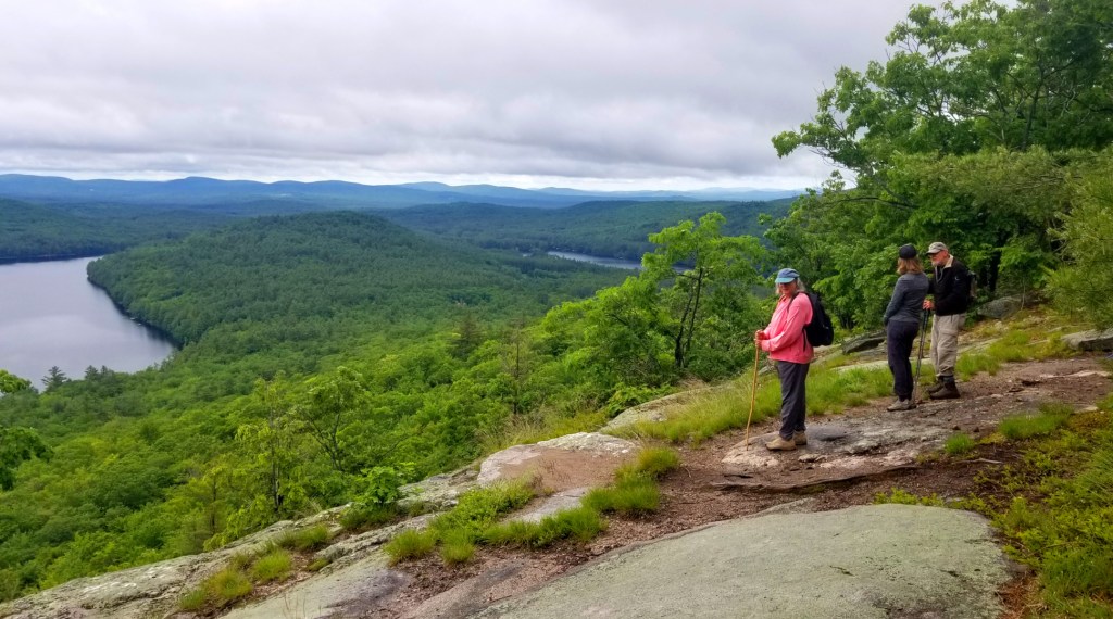
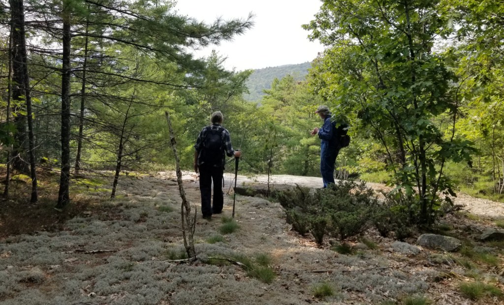
The Bald Ledge Preserve was our first holding in the Porter Hills. The overlook commands an inspirational view of Colcord and Bickford Ponds and the surrounding hills. Thousands have enjoyed this scenic place, which is described in many trail guides.
For years the National Audubon Society (NAS) oversaw a 25-acre parcel next to the ledges, a gift of the Giovanella family of the Bickford Pond area who retained ownership of the ledges and approximately 200 additional acres. Since the Audubon Society is headquartered in New York City, they decided a few years back that a local organization in Maine might be better able to manage the property. They contacted the Francis Small Heritage Trust to see if we would be interested in owning and protecting the property. (We said yes, of course!)
In the summer of 2010, NAS officially transferred its holdings near Bald Ledge to the Trust — as a gift, in addition to including a generous stewardship endowment. The Forest Society of Maine, represented by its then Director of Forestland Conservation, Peter McKinley, kindly agreed to hold an easement on the property.
Bald Ledge is more than just a view. The MNAP has identified in the vicinity of the overlook ledges an Ironwood-Oak-Ash Woodland forest community and two rare plants, Bottlebrush Grass and Douglas’ Knotweed. We will be watchful for other rare plants that are likely to be found in the Porter Hills.
During the summer of 2016, a group of students with the Oxford County Youth Conservation Corps, led by Gabe Perkins, improved upon a newly blazed trail leading to the ledges. The trail from the Varney Road parking area to the overlook is 1.4 miles, 30 minutes round trip. This is a relatively easy hike, with more details in the Trails & Maps section of this website. NOTE: Parking access for this trail is closed in winter.
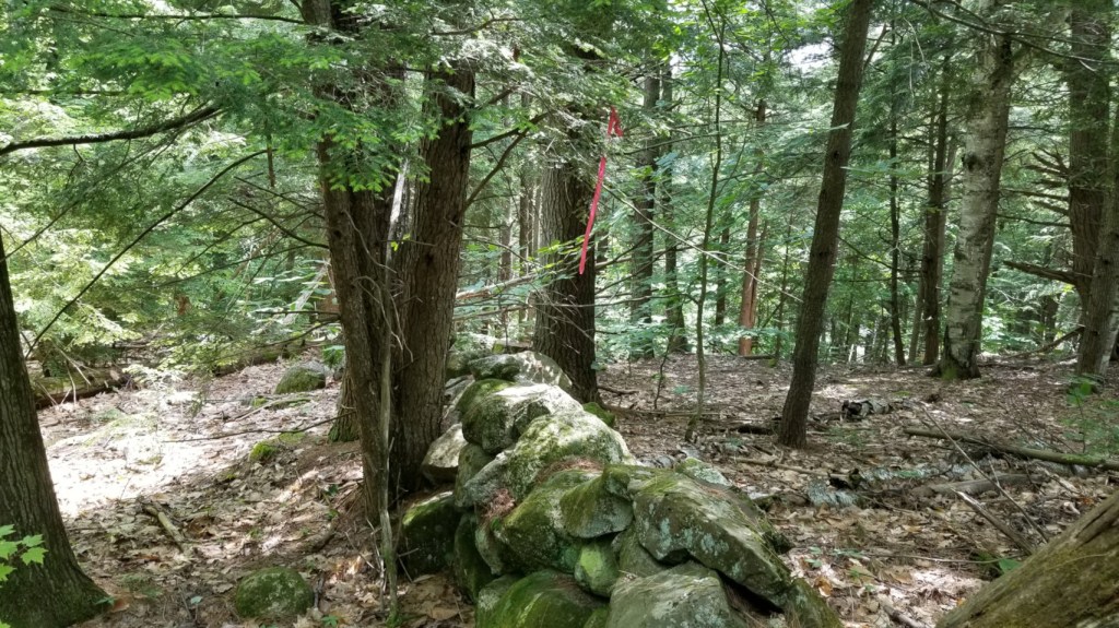
The Bald Ledge Summit property of 199 acres is most of the land to east of Kennard Hill Road and south of Varney Road. This property was donated as a very generous gift to FSHT by the Giovanella family to be used as matching value for an LMF grant used to acquire other Porter Hills properties during 2024. As the name suggests, this parcel includes the true summit of Bald Ledge Mountain (1190 ft) which is just a short distance SW of the ledge viewpoint noted above. But the Bald Ledge Summit property is much more than a hilltop with great views; the land varies from a complex of wetlands near the southern boundary to a long, ascending south-to-north ridge. This ridge-line has hemlock-pine forests to the west, and sunny mixed hardwood forests on the east slopes. A part of the backbone of this ridge is capped by a long, historical stone wall signifying the centuries-past clearing of pasturelands here, and now the more recent re-growth of successions of forests.
All lands that are properties where LMF funding supported the acquisitions are encumbered by an LMF Project Agreement which has similar restrictions to those of a conservation easement. All LMF-acquired properties have to be assured to be open to the public for hunting, hiking, and other low-impact outdoor uses. Bald Ledge Summit has the additional conservation protection of a declaration of trust that assures that this forest land will have no commercial timber harvests, and this protection may also be enhanced when FSHT decides to designate these 199 acres as forever wild.
During 2024, FSHT made significant investments to improve public access for all of the Bald Ledge properties:
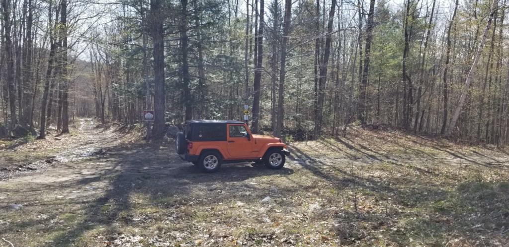
From the North: The Varney Road was improved for better access by all vehicles, and the parking area was reconstructed to have and stable surface and ditching to keep rain and melt waters out of the parking area and road. A new information kiosk was installed. Beyond the parking area, Varney Road was improved enough to create water bars and drainage ditches to direct surface waters out of the road, protecting the parking area and lower roadway. NOTE: Varney Road and the parking area are NOT maintained for winter use.
From the South: A new 50×50-ft parking area was developed to enter from the Colcord Pond Road. This Colcord Pond Road parking area also has a new information kiosk. This parking area now serves as the trailhead for the new Bald Ledge Summit Trail.
Marked by the usual red-and-yellow “turtle” badges. This trail is a route of about 1.0 miles from the parking area to the same view ledges of the Bald Ledge Preserve, but… due to the long ascent… this trail requires more exertion than the original trail from Varney Road. Directions to the trailheads and more details of the trails are in the Trails & Maps section.
Devils Den (46 acres)
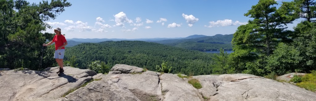
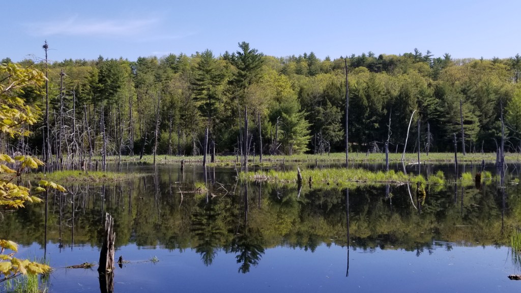
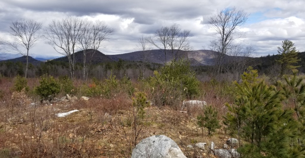
The Devils Den property is the “capstone” of our Porter Hills acquisitions. The view from the Devils Den overlook is at least as awesome as the Bald Ledge views. (See the panorama photo at the top of this page.) The actual “Devils Den” or “Devils Cart Road” is a deep cleft in the ledges about 100 ft to the west of the viewpoint.
When visitors are at the Devils Den ledge viewpoint, attention is easily captured by the spectacular, sweeping panorama to the south. However, visitors should also turn around and face the north. This place also has a view to the north of the White Mountains and the distant Presidential Range.
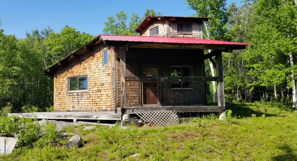
Another feature here is the “Kamys Cabin,” a lodge that we now own and intend to develop as an educational resource center. The cabin needs repairs and maintenance work, and we will update the actual planning in future newsletters.
This Devils Den in Porter has a long history as a popular place for visitors to enjoy the spectacular views. There were settlements in this area from the early 1800s. As this 1858 map shows, many familiar family names were represented in nearby homesteads and farms. A Douglass family had a farm that is north of the Snake Road intersection. The Pearl and Brooks families were on what is now our Devils Den property; their cemetery and the old farm foundations are on our properties. Notice, especially, that there was a schoolhouse at the intersection of Moody Road, Devils Den Road, and Norton Hill Road.

The roads on this map still exist today, although some are now discontinued for maintenance. Many historical photos confirm what the map suggests; much of this land was then cleared for farms, gardens, and pastures. The complex network of stone walls developed from that clearing and agricultural use.
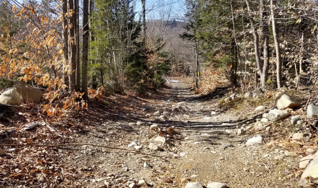
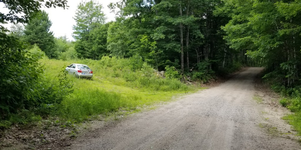
Access to this Devils Den property has some issues at this time. The original access route is the Snake Road from Moody Road, but serious erosion damage makes this currently unsuitable for vehicular access, and it is also a very rough walking surface. The other existing access route is a long-established ATV trail from the Devils Den Road (DDR). The Land Share Riders (LSR), the club that maintains most ATV trails in this area, has temporarily closed this trail for repairs. The trail is in very poor condition with severe erosion and very deep mud wallows.
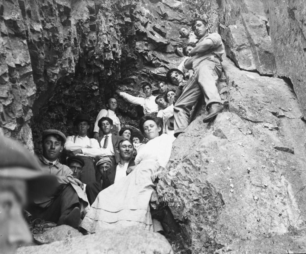
We are not certain of the date (Photo by George French (1882-1970), perhaps 1900. From the Maine Archives.), but this historic photo shows “hikers” ascending the “Devils Cart Road” at a time more than a century ago. The young folks in this photo were certainly a hearty gathering, to climb the ledges in the wardrobes of those times!
In more recent times, parts of this area were owned by Stacey family members. In 1991, they sold to Kris Kamys what is now our Devils Den parcel. Mr. Kamys, for many years, owned and managed the Maine Teen Camp on Stanley Pond. Working with local contractors, he had the Snake Road developed, and the “Kamys Cabin” lodge constructed. Mr. Kamys cooperated with FSHT as we pursued the acquisition of this property with the assistance of LMF funding grants and donations from many others.
In May of 2023, FSHT became the owner of the Devils Den Property. Since then, we have accomplished several projects to make this place better available for public use. During November of 2023, we had a local contractor develop a new 60×60 ft parking area, accessed from Moody Road. At that time we started the development of a new footpath trail for a better experience for hikers to ascend to the view ledges. By June 2024, the trail was completed and a new information kiosk was installed.
For directions to Devils Den and for a detailed description of the new Devils Den Trail, see the Trails & Maps pages.
There are also two other access routes from Moody Road to Devils Den:
- The Snake Road is available as another hiking route and is available in winter for snowmobiles. This is also our FSHT access for maintenance at the cabin and ledges, but we do not allow ATVs or 4x4s to use this trail at other times because the maintenance of this road is difficult and expensive. During the fall of 2024, we had a contractor work to develop water bars on Snake Road and to fill in some deep gullies that were formed by vehicle erosion and water deluges. The water bars will divert water out of the road to limit wash-outs for a few years.
- There is also a long-established ATV trail from the Devils Den Road to the ledges. However, heavy use by ATVs during recent years has so badly eroded this trail that it has mud holes several feet deep and berms of splashed-up mud that block water from draining out of the trail. It is our intention to work with the local ATV club, the Land Share Riders (LSR), to improve the ATV trail… to make better drainage, and to fill the deep holes… but this will take significant, expensive contractor work. In 2023, LSR officers walked the trail with FSHT board members; all agreed that ATV use should be suspended until the trail can be improved with better drainage and a solid surface.
At the same time that we had the Snake Road improvements, a contractor mowed the two-acre field by the ledges and cabin. Our Project Agreement with the LMF allows us to keep that field cleared for the views and as a habitat for birds and pollinators. The mowed area and vehicle use now stop at about 150 ft from the ledges overlook. To protect sensitive vegetation near the ledges, no vehicles are allowed within 150 feet of the scenic cliffs. Signs and a rope line will be found marking the protected area. If you arrive here by snowmobile or other vehicle, please park north of the roped-off area, and walk the short distance from there to the ledges. We will be trying to have this broad clearing mowed at intervals of every two to four years.
Giovanella Family Forest (167 acres)
This parcel has the highest elevation (1340 feet) of any of our properties in Porter. It has a conservation easement with the Forest Society of Maine and is designated for forest management that will have harvests in some areas where the terrain is suitable for practical logging and where thinning would help to maintain the forest’s health.
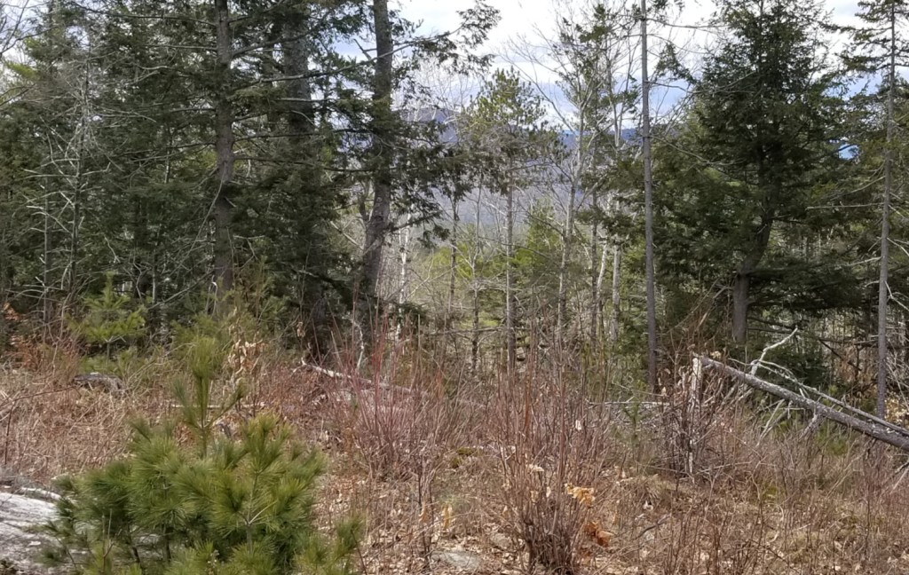
Currently, there are no trails on this property, so please explore these lands carefully whenever ascending the rough terrain. From some of our visits here, we know that there are places along the northern boundary where… partially obscured by trees… there are viewpoints where we can actually see the red roof of the distant Kamys Cabin. Ascending further, we know that near the NW corner, there are some ledge outcrops and there may be viewpoints. If visitors have the opportunity to visit the highest areas, near the state line, please take some photos to show the terrain and views and share some photos with us.
Along the southern boundary, about halfway to the top, there is an area of exemplary pine-oak forest which is worth the walk to see. In this ecosystem, the forest floor is surprisingly clear of brush and saplings.
This property was also owned by the Giovanella family and was donated to FSHT for conservation and to assist with the purchase of four other parcels: Devils Den (above), Fox Brook, Herons Haven, and Blueberry Hill (the next three properties below).
Fox Brook (70 acres)
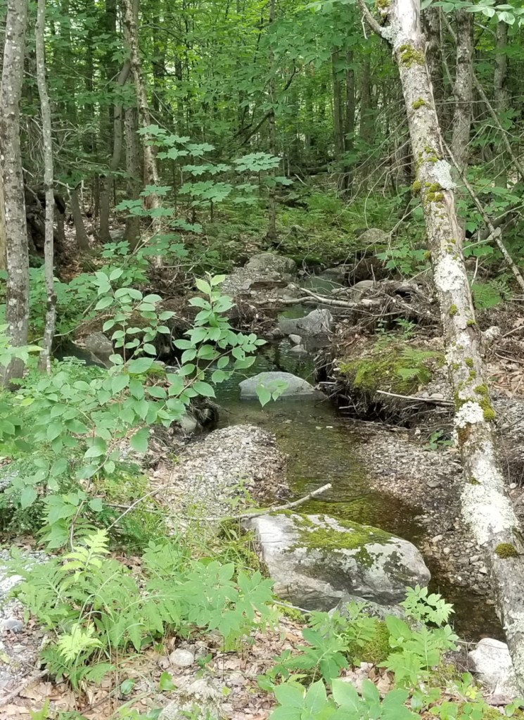
This is forested land with variable terrain and with the Fox Brook running southward through this parcel. Fox Brook eventually drains a large watershed to the Black Pond (aka Black Bog) that is to the southeast of this area.
This parcel is contiguous with the next two properties. Together, these three parcels form a solid block of 155 acres, enhancing the connectivity and resilience of our properties here.
At this time, we have no developed hiking trails here. However, there is a good viewpoint near the southwest boundary of this property, and future trail development should include access to this point. For now, previously developed logging roads provide some access routes. The easiest access at this time is to come southward on Devils Den Road (not maintained, very rough) from Norton Hill Road (The access road to Devils Den.). As the Devils Den Road descends, it passes through part of the Norton Hill property, then passes by the Blueberry Hill and Herons Haven parcels on the left. At the SW corner of the Herons Haven property, a logging road leaves the Devils Den Road, heading eastward. This logging road serves as access for both the Herons Haven and the Fox Brook property.
See also the Norton Hill property for more details of Fox Brook.
Herons’ Haven (22 acres) and Blueberry Hill (64 acres)
Herons’ Haven includes a remarkable 10-acre wetland and blue heron rookery that has been maintained and enhanced by beaver activity. To view the wetland, walk to the base of the steep sections of the Devils Den Road, then turn eastward onto the right-of-way logging road that runs along the south boundary of this land. A short distance along that road, there is an opening with views to the north across the waters of the beaver pond. (A future development may be to install a gate on the logging road and signage describing this unique beaver pond ecosystem and the significance of the heron nesting area. This would also explain why public access is restricted at times to protect the herons during seasons of nesting and fledging.) Continuing eastward on this same logging road will take you into the Fox Brook property (as described above).
Blueberry Hill, high above Herons Haven, is mostly mixed forests with steep slopes descending southward. There are some limited viewpoints at ledge outcrops along these highlands. We expect to develop new hiking trails across Norton Hill and Blueberry Hill.
The Great Porter Heath (134 acres)
The land that FSHT has acquired here includes about half of the area of the Great Porter Heath, an expansive complex of wetlands, stream channels, and small ponds. We also own about 75 acres of forested upland slopes that are watersheds for the wetlands.
Directions to the FSHT Porter Heath:
The Great Porter Heath parcel has a half mile of frontage on Old County Road (“Breakneck Hill Road”) and this land is most easily reached by driving south on that road from Brownfield. Where Heath Road intersects from the East, this is the NW corner of our FSHT property. Using Heath Road, you can find old logging roads that will lead to places that are close to the margins of the wetlands. Parts of this logging road access will be flooded at times due to beaver activity. One branch of the logging roads crosses the stream at a beaver dam.
In addition to the natural area features of this property, there are also many historical landmarks here. Along the Heath Road, there are cellar hole foundations of three early homesteads, and there is also a small cemetery. But the history here also predates the settlements of early Americans; open areas along the margins of The Heath are also known to have been meeting places for Wabanaki tribes from around this vicinity. As we continue work here, we will develop some of the logging roads into access trails, and there will be a kiosk with information about the access and uses, as well as the Wabanaki and early American history of this place.
Despite the restrictions that protect this land, this property is open to the public for hiking, hunting, nature study, and other low-impact uses. No motorized vehicles are allowed except on Old County Road and Heath Road.
As described in the Acquisition History further below, this land is protected by a Project Agreement with the Maine Natural Resource Conservation Program that restricts us from any timber harvests here; this limitation of forest management assures that the run-off of rain and meltwater from this hillside will have minimal sediments and contaminants and helps to protect the water quality of the Porter Heath. Like most major wetlands, this heath serves as a natural reservoir for deluge rains, limiting the erosion that may be caused by heavy run-off in downstream areas. The heath is also a significant wildlife habitat and the many ecological functions and values of this property are detailed in a 2021 Maine Natural Areas Program Site Visit Summary (copies can be made available).
Moody Road North (31 acres) and Moody Road South (67 acres)
As the names suggest, both of these properties have frontage on Moody Road. As you see in the Project Map, two rectangular land parcels are almost entirely surrounded by our lands. The rectangular parcels, about 9 acres to the north and 6 acres to the south are owned by Land in Common, another land trust. The La Finca Farm Cooperative leases this land and is working to develop it as working farmlands. We work in close cooperation with the La Finca members to monitor the lands, share the public access, and work together on some projects.
Moody Road North has 170 ft of road frontage, directly across the road from our Devils Den property. As shown on the Project Map, this road frontage is the south end of this property, with this width of land extending northward for 600 ft to where the property enlarges and extends to the margins of the Porter Heath. A small stream that begins at a spring on the Devils Den property runs through a culvert under Moody Road and continues northward on this property, eventually adding to the waters of the Porter Heath.
It is our intention to have a trailhead near this brook, and a new trail to run to the NW across this property to eventually end at the edge of the Porter Heath.
This property is a large extension of our Devils Den property. We have started work to develop a new trail to start on the Devils Den Trail and run westward across parts of both properties.
Moody Road South has more than a quarter mile of frontage on the road. Except for two small clearings, most of this property is forested as a mix of hardwoods with some pine and hemlock.
Moody Road South also has an access road, similar to Snake Road, that crosses a corner of Land in Common property and gives us easy access to a clearing and viewpoint near the SE corner of the property.
Norton Hill (130 acres estimated)
We are in the process of acquiring this property and hope to own it at some time in early fall of 2025. As you see in the Project Map, this acquisition connects Blueberry Hill to Devils Den. With all of the properties to the south of Moody Road connected, this makes a solid block of almost 400 acres; a better opportunity for resiliency with climate change and for wildlife migration. In addition to that, the Norton Hill parcel has about a half mile of road frontage on Norton Hill Road; this assures that there will not be residential or commercial development along our side of the road for all of that distance. However, there is one feature along that stretch of the road that is a benefit for our planning of improved public access; where there was once a timber harvest log yard, we have an almost-ready-to-use parking area. This will become a trailhead for new hiking trails on this property.
A few hundred feet east of where the previous photo was taken, there is a brook crossing. This is Fox Brook; this brook continues southward across the Norton Hill parcel, and continues across the Blueberry Hill parcel, eventually running north-south for the length of the Fox Brook parcel.
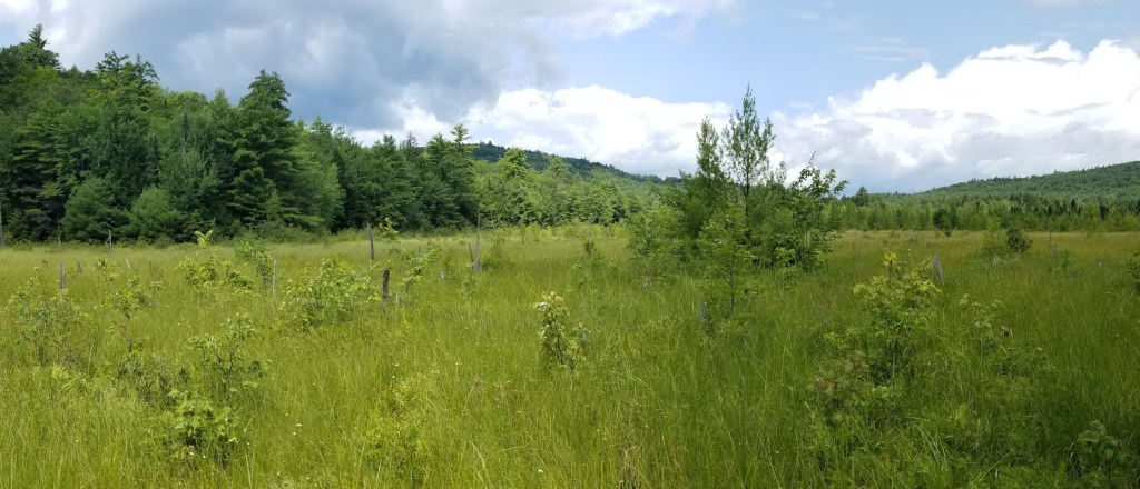
There is a very good reason for developing a new hiking trail on this Norton Hill land. About 30 acres of the middle of this land was extensively clear-cut less than ten years ago. This was devastating for the environmental health of this area, but it will recover and will sequester significant carbon as larger trees eventually grow. At this time, this clearing does serve two other purposes.
We will eventually make new hiking trails to enable visitors to enjoy these broad views. Since we will allow revegetation of this area, the views will become more limited over time, but we will ensure that trees in some areas are limited to maintain some views. We have also seen another use here; this is a significant browse area for deer and moose during each winter. The blueberries and other shrubs remain easily accessed by the animals, where sweeping winds limit the depth of snow accumulation.
There will be more details of the development and use of our properties as we continue to make progress in our work.
Acquisition History of all the FSHT Porter Hills properties.
For years the National Audubon Society (NAS) oversaw a 25-acre parcel next to the Bald Ledges, a gift of the Giovanella family of the Bickford Pond area who retained ownership of the ledges and approximately 200 additional acres. Since the Audubon Society is headquartered in New York City, they decided a few years back that a local organization in Maine might be better able to manage the property. They contacted the Francis Small Heritage Trust to see if we would be interested in owning and protecting the property. (We said yes, of course!) In the summer of 2010, NAS officially transferred its holdings near Bald Ledge to the Trust — as a gift, in addition to including a generous stewardship endowment. The Forest Society of Maine, represented by its then Director of Forestland Conservation, Peter McKinley, kindly agreed to hold an easement on the property. During the summer of 2016, a group of students with the Oxford County Youth Conservation Corps, led by Gabe Perkins, improved upon a newly blazed trail leading to the ledges.
The Bald Ledge Preserve was the first of the now-expanding FSHT property ownership in the Porter Hills, but ours is not the only conservation effort here.
The Maine Woodland Owners (MWO, formerly “SWOAM,” Small Woodland Owners of Maine) owns a 50-acre parcel (shown on our Project Map) called the Norm Nelson Forest. This was donated to MWO in 2014 by the family members of Mr. Nelson, for whom the parcel is named. The MWO maintains this property for well-managed commercial timber harvests and “…to allow foot traffic only for walking, hiking, birding, hunting, and general recreation.” FSHT has worked cooperatively with MWO, and that organization has provided letters of support for some of our acquisition projects.
In addition, the Giovanella family has worked in close cooperation with the Forest Society of Maine (FSM) and has provided FSM with several conservation easements to protect some family-owned lands for future generations. On the Project Map, you see some of these protected lands along the shores of Bickford Pond.
During 2021 and early in 2022, FSHT developed our vision of conserving other lands that have been on the market in the Porter Hills area, and the efforts that we would make to acquire some of these lands. All of this work is named as our Porter Hills Initiative, which we have been accomplishing as a series of phased projects. Phase I has been accomplished, Phase II is almost completed, and we have preliminary work starting for Phase III. Our planning was guided by the MNAP Porter Hills Focus Area report; one of a series of about one hundred state-wide study areas that have been identified as critical sites for conservation importance.
In March of 2022, we acquired the Porter Heath parcel: 134 acres including more than 50 acres of the heath wetlands. This property was purchased with most costs paid from the Maine Natural Resource Conservation Program, a fund that is created from the fees of contractors who need to work in wetland areas and intended to protect significant wetland areas. The Porter Heath is important both for the diversity of wildlife supported by the wetlands, but also for the historical importance of some of this open space as a favored meeting place for Wabanaki tribes. There are also the remains of historic homesteads and cemeteries. We will soon be providing interpretive signage, and developing some walking trails for a closer approach to the wetland features.
Also, in 2022, FSHT board members negotiated with the owners of the Fox Farm properties to accomplish a conservation easement on 46 acres of that Fox Farm land. This easement area is also shown on the Project Map.
During 2023, we continued working on the requirements of the Land for Maine’s Future program (LMF). There are many requirements for acquisitions to be supported by LMF: detailed surveys, appraisals, environmental assessments, and other needs. This diligence work is expensive and these costs would have impoverished our land trust, but we were able to accomplish all this work with the help of many donors. We are very grateful for a grant of $15,000 from the William Wharton Trust fund, a grant of $103,000 managed by the Southern Maine Conservation Collaborative, a grant of $20,000 from the PF Fund of Baldwin, and for many generous donations from the Bickford Pond Fund, the Giovanella Sokal Fund, and from dozens of others. We are also very grateful for the cooperation of land owners who were willing to sell to us and to have patience as we worked for more than a year to accomplish all the needs.
The LMF project would never have developed had it not been for the exceptional generosity of the Giovanella family, land owners of this area of Porter since the 1940s. LMF funds are only provided by the State to pay for up to 50% of the cost of the purchase of approved lands. The other 50% must be paid by other funding provided by the purchasing land trust. The grants and donations mentioned above provided funds to pay for most requirements of making these purchases, but most of those gifts were used for expenses; not for the actual purchase of the lands. To make the land purchases possible, the Giovanella family donated two incredible land parcels shown on the Project Map (outlined in orange) as the Giovanella Family Preserve (on earlier maps, named as “Bickford Slopes”) and Bald Ledge Summit. Together, the value of these donated parcels exceeded $400,000. With that amount of matching value, the LMF grant paid for the acquisition of the other three parcels outlined in orange on the Project Map.
On May 22nd, 2023, we received the final LMF approval and a grant of $388,000 that accomplished the purchase of the Devils Den, Fox Brook, and Blueberry Hill / Herons Haven parcels. The Newsletter in the Shopping Guide of 2023 August 9 was a part of our celebration for the success of these projects. Yay!! (Copies of the FSHT newsletters are available on this website in the “News” link.)
Since we accomplished the Phase I acquisitions, we have been working hard to improve public access infrastructure for these properties. During 2023 and 2024 we accomplished the following improvements:
- New parking areas on Moody Road and Colcord Pond Road.
- Improved parking area and road access on Varney Road.
- New information kiosks at all of the above parking areas.
- New Devils Den Trail from Moody Road to the ledges.
- New Bald Ledge Summit Trail from Colcord Pond Road to the summit.
Meanwhile, we began work on the Porter Hills Initiative, Phase II. We had long been trying to negotiate with the owner of lands to the west and NW of Devils Den, and an opportunity finally developed. In April of 2024, we acquired the two “Moody Road” properties, but the short time required to accomplish the purchase did not provide time to secure adequate grants and gifts. We had to use a loan of $178,000 from the Maine Coast Heritage Trust to make the purchase, and then we worked until November to raise the funds to pay off the loan. Again, LMF provided a grant for half the cost of the land ($89,000), and we had additional grants from Momentum Conservation, the Davis Conservation Foundation, and many other local donations and gifts.
At the same time that we were working to pay off the loan for the Moody Road properties, we also found that the Norton Hill property could be acquired. This land was purchased by a conservation-minded individual who is holding this property for us until we can raise the funds to close on this acquisition. Again, LMF will pay for half the property value, and a grant from the Maine Outdoor Heritage Fund will contribute $25,000 for the acquisition costs. We are working now to raise the funds to complete this purchase, and any donations are always VERY welcome.
Regarding public access improvements, when we own the Norton Hill property we will develop another new parking area. We also have plans for new trails on all of the Phase II properties.
And, we have tentative plans developing for Phase III, for another major land acquisition. Perhaps there will be news about this when we develop our next “Tidings of the Turtle” newsletter in Your Weekly Shopping Guide, probably on a date in August.
Please contact the Trust if you own land that you would like to see added to the protected areas.
