
Quick Links: Bald Ledge Preserve Trail, Bald Ledge Summit Trail, Devils Den, Ingalls Pond, Sawyer Mountain, Jagolinzer Preserve, Heath Loop Trail
Porter Hills / Bald Ledge:
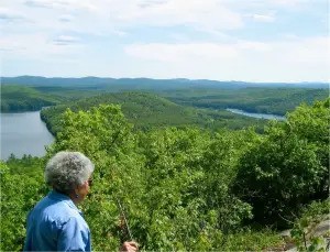
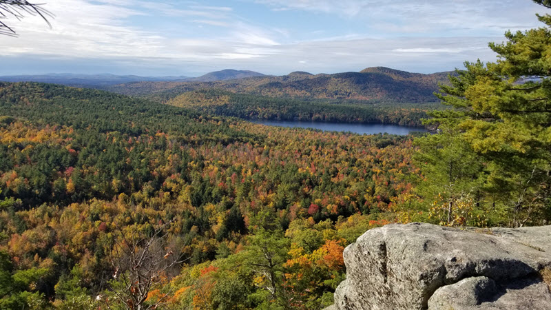
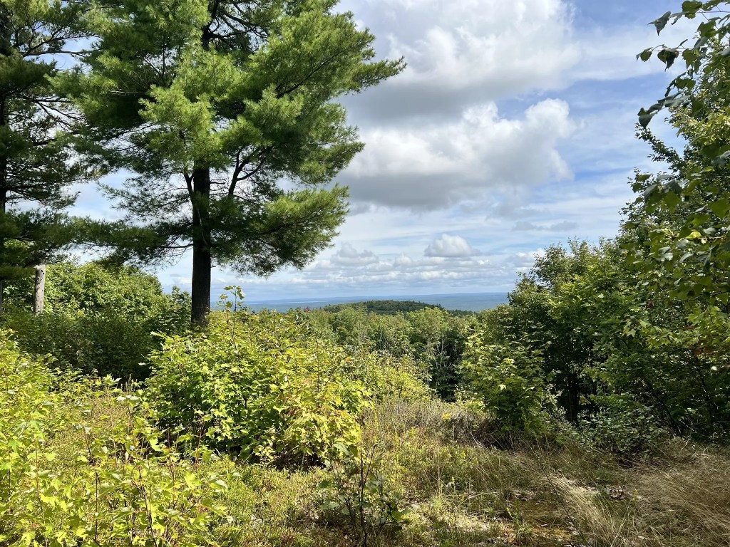
The Bald Ledge overlook in Porter, Maine, commands an inspirational view of Colcord and Bickford Ponds, the surrounding hills, and expansive views to the south.
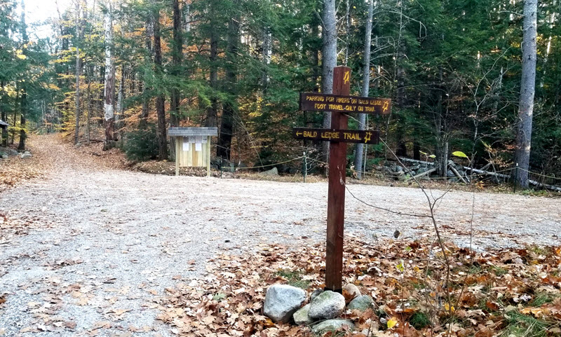
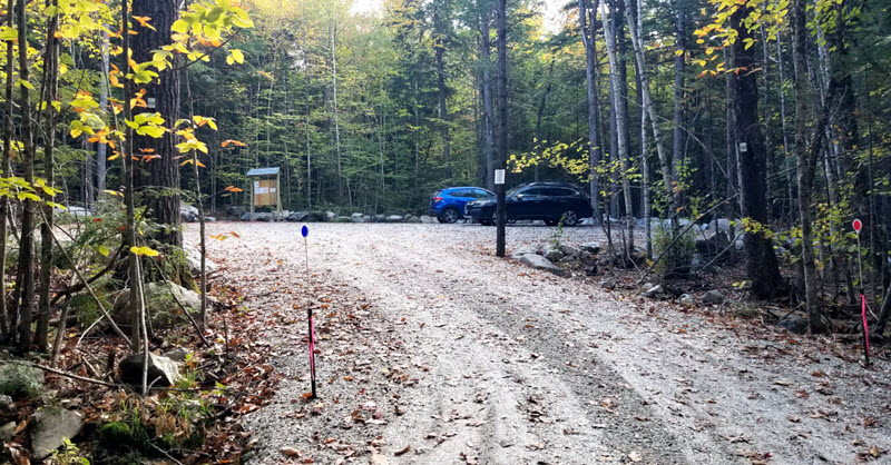
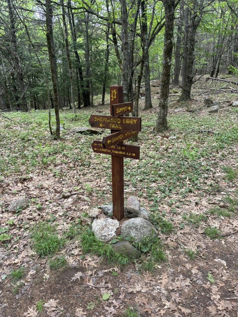
FSHT has owned the 26-acre Bald Ledge Preserve since 2010 and has long maintained the trail from the Varney Road parking area to the summit ledges of Bald Ledge. In 2022, FSHT accepted, as a gift from the Giovanella family, 199 acres of land, now known as Bald Ledge Summit. This extended the original preserve to the south and west and enlarged this property to a total of 225 acres. During 2023-2024, contractor work improved the Varney Road and the original parking area. Our contractor also constructed a new parking area accessed from Colcord Pond Road, near the south end of this property. Volunteers developed the new Bald Ledge Summit hiking trail from the new parking area and also installed new information kiosks at each trailhead.
Bald Ledge Preserve Trail:
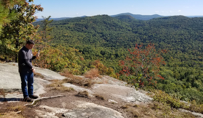
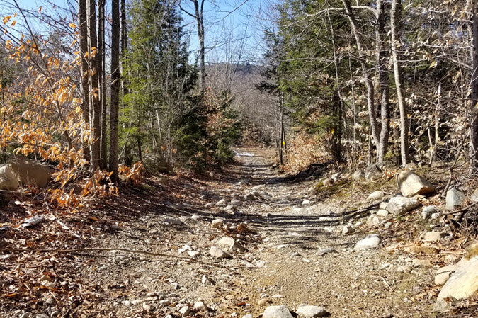
The Bald Ledge Preserve Trail is 0.7 miles one way. Elevation gain: about 270 ft. Degree of difficulty: Easy. Trail Map on AllTrails, FSHT Trail Map. From the kiosk in the parking area, walk eastward on Varney Road for about 0.2 miles. The footpath trail departs from the road, heading south, through a break in a stone wall, marked by FSHT trail signs and red/yellow “turtle” trail markers. The trail is mostly a gentle ascent but becomes somewhat steeper as it approaches the summit ledges. At the summit, with spectacular views, the elevation is about 1185 ft.
Descending: At the Bald Ledge Summit view ledges, trail markers head northward to descend the Bald Ledge Preserve Trail to Varney Road. The same red/yellow “turtle” trail markers also head southward to descend the Bald Ledge Summit Trail; on this trail, the distance to the Colcord Pond Road Parking Area is about 1.0 mile.
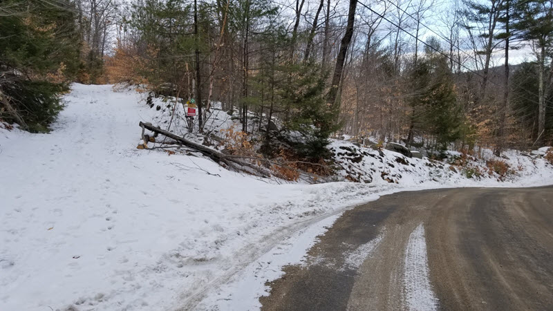
- Note: Varney Road and the parking area for the Bald Ledge Trail are closed in winter.
- Note: Do NOT park on Danforth Lane or on Kennard Hill Road.
Directions:
From the bridge over the Ossipee River in Kezar Falls:
Drive west on Maine 25/160 for 0.7 mile. As the highway curves to the right, bear right onto Colcord Pond Road, which is heading uphill to the NW. Continue northward on Colcord Pond Road for almost 5 miles. At a fork where Colcord Pond Road is nearly straight ahead, bear left on Dana Weeks Road. Almost immediately, bear right on Kennard Hill Road. Continue uphill on Kennard Hill Road for almost 1.5 miles. Where the pavement ends, turn right onto Danforth Lane. At about 100 yards, Danforth Lane turns left, and Varney Road is a slight turn to the right. The Bald Ledge parking area is about 200 yards east on Varney Road.
From the west:
Driving eastward on Maine 25, Maine Route 160 enters from the right as you enter Porter Village. In Porter Village, after crossing the bridge over Mill Brook, turn left onto First County Road (aka Old County Road). Go northward on First County Road for 1.5 miles, to where it merges with Colcord Pond Road. Continue, as in the previous directions, for almost 2.2 miles on Colcord Pond Road, to the turn onto Dana Weeks Road.
On Varney Road, enter the FSHT Bald Ledge parking area. To the left of the kiosk, the Varney Road continues eastward and is also the first 0.2 mile of the Bald Ledge Trail.
Bald Ledge Summit Trail:
The Bald Ledge Summit Trail is about 1.0 mile one way. Elevation gain: about 575 ft. Degree of difficulty: Moderate. FSHT Trail Map, Trail Map on AllTrails. The trail starts at the SW corner of the parking area, to the left of the kiosk, and is marked by red/yellow “turtle” trail markers. The trail runs westward for a short distance, then turns northward and begins a persistently steady ascent of the main ridge. At a point that is about halfway up the mountain, the trail turns westward to cross a shallow valley and continues the ascent on an adjacent ridge. Part of the upper trail is near a historical stone wall. It enters hemlock forests briefly before emerging through a patch of ironwood-oak-ash forest community near the scenic ledges. The summit elevation is approximately 1185 feet.
- Note: This parking area is not maintained in winter. In winter, you may park along the side of Colcord Pond Road, but be certain to leave space for passing traffic.
Directions to the Bald Ledge Summit Trail on Colcord Pond Road
From the bridge over the Ossipee River in Kezar Falls:
Drive west on Maine 25/160 for 0.7 mile. As the highway curves to the right, bear right onto Colcord Pond Road, which is heading uphill to the NW. Continue northward on Colcord Pond Road for almost 5 miles. At a fork where Dana Weeks Road is to the left, stay straight ahead on Colcord Pond Road. In about a quarter mile you will see Lady Slipper Lane on the right; continue on Colcord Pond Road for another quarter mile. The Bald Ledge Summit parking area is on the left.
From the west
Driving eastward on Maine 25, Maine Route 160 enters from the right as you enter Porter Village. In Porter Village, after crossing the bridge over Mill Brook, turn left onto First County Road (aka Old County Road). Go northward on First County Road for 1.5 miles, to where it merges with Colcord Pond Road. Continue northward on Colcord Pond Road for almost 2.2 miles, to where Dana Weeks Road is on the left. Then continue, as in the previous directions.
Other Hiking Routes around Bald Ledge:
Old roads around the Bald Ledge property can be used as alternative hiking routes.
Varney Road
If you can drive to the FSHT Varney Road parking area, you have already driven on a part of Varney Road, and continuing eastward from there, Varney Road is actually part of the Bald Ledge Preserve Trail for about 0.2 mile. From where the Bald Ledge Preserve Trail crosses a stone wall, leaving the road and heading southward, the Varney Road continues eastward for about a quarter mile to where it intersects the Breakneck Hill Road. In winter, the Varney Road is not plowed or maintained, so visitors need to walk eastward from Kennard Hill Road, first on Danforth Lane, then on Varney Road. HOWEVER, in winter there are no spaces for parking on Kennard Hill Road or Danforth Lane. Visitors will need to either walk some distance on Kennard Hill Road, or get dropped off at Danforth Lane.
Bald Ledge as a loop hike
Using the roads described above, the most obvious loop hike would start from the Colcord Pond Road parking area.
Hike the Bald Ledge Summit trail to the summit ledges.
Then hike the original Bald Ledge Trail (aka Bald Ledge Preserve Trail), descending to the Varney Road.
Instead of turning left to go to the Varney Road parking area, turn right on Varney Road and then turn right again when you have reached Breakneck Hill Road.
Descending the Breakneck Hill Road will take you to Colcord Pond Road.
Then walk the roadside of Colcord Pond Road to return to the parking area.
Total distance: about 2.7 miles.
Breakneck Hill Road (aka Old County Road)
Colcord Pond Road is part of the eastern boundary of our Bald Ledge Preserve property. From the entrance of the Colcord Pond Road parking area, and driving or walking northward, it is about 0.3 mile (500 yards) to where the road takes a sharp right turn and heads eastward to camp roads at the head of Colcord Pond. At that turn, at times when roads are clear, it can be possible to park 2 or 3 vehicles in the space beside this turn.
At this turn of Colcord Pond Road, the Breakneck Hill Road continues straight ahead, ascending the hillside. This road, like many other abandoned roads of the Porter Hills, is available for public use, but it is too rough and eroded to be used by most vehicles. For vehicles on this road, high clearance 4x4s and ATVs are capable. For hiking, the road is very rough and the many loose stones risk turning an ankle, but walking along the edges is usually easy. Leaving the maintained road and heading northward, at about a half mile (880 yards) the intersection with Moody Road will be on the right. (More about Moody Road below.) Continuing another 250 yards northward, the Varney Road is to the left.
From Varney Road, if we continue northward on Breakneck Hill Road, we will reach Heath Road at the NW corner of our Porter Heath property.
Where Colcord Pond Road turns to the east, the Breakneck Hill Road (unmaintained) continues straight ahead to the north.
Porter Hills / Devils Den:
Visitors have come to Devils Den for more than two centuries. (More details) The spectacular views and the fascinating ledge formations have drawn many to hike or ride to this remarkable place. During 2022-2023, FSHT acquired this property as a part of our Porter Hills Phase I Initiative, an acquisition of six parcels with a total area of more than 550 acres, all assisted by funding from the Land for Maine’s Future program, local gifts of properties, and other generous grants. Our acquisition ensures public access for hiking, hunting, nature study, and other low-impact uses. This also preserves access for snowmobiles and other vehicles, but that use is limited to specific roads and trails designated for those uses.
There are three routes for access to the ledge viewpoint:
- The new Devils Den Trail is a footpath woods walk with attractive features, and with plans to further develop this trail as a part of a larger trail system extending into more recently acquired lands to the west.
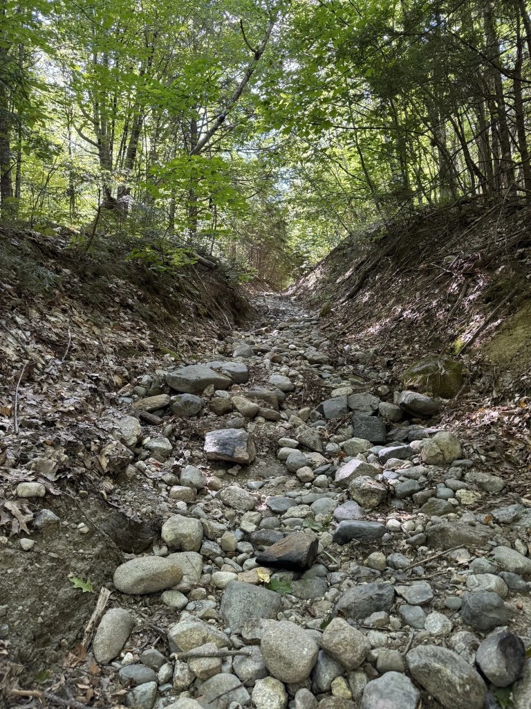
- The Snake Road is an unimproved access road used for land trust maintenance work, and where snowmobile access is allowed whenever snow cover is adequate for the protection of the road surface and adjacent vegetation. This has also been used as one of the original hiking trails, but it is a rough and rocky walk.
- The ATV Trail has long been used but is currently closed for such use by agreement with the local ATV club due to the badly eroded conditions of the trail. This has also long been used as a hiking trail access, but the erosion… especially the deep mud holes in the trail… makes it a discouraging footpath route.
The Devils Den Trail is a relatively easy 0.5-mile hike (one-way) with an elevation gain of approximately 250 feet. You can find trail maps on AllTrails, FSHT Trail Map.
The trailhead begins at the parking area on Moody Road, just to the left of the information kiosk. After crossing a drainage ditch on stepping stones and hemlock bridging planks, the trail gently ascends through a diverse forest of hemlock, pine, birch, and hardwoods.
About 150 yards in, the trail approaches a stone wall marking a property boundary; please respect the “No Trespassing” signs and stay on FSHT land. The trail continues southwest, reaching Snake Road at the 0.25-mile mark. Here, you can choose to (1) turn left onto Snake Road for an alternate route to the summit ledges and cabin or (2) turn right to descend back to Moody Road.
Crossing Snake Road, the Devils Den Trail continues nearly level for 200 feet before reaching a signed trail junction. Take the left turn to stay on Devils Den Trail; the path straight ahead is the dead-end “Spur Trail.” From the junction, the Devils Den Trail ascends eastward through a forest primarily of beech, birch, and maple.
As you approach the summit ledges, the trail levels out, revealing wide clearings to the left. These clearings, maintained by FSHT, offer views to the north and west and provide habitat for birds and pollinators.
After enjoying the summit views, take a short side trail to the head of “The Devils Cart Way,” a large cleft in the ledges with a steep drop. Exercise caution here.
The FSHT Devils Den parking area, viewed from the entrance on Moody Road. The Devils Den Trail starts to the left of the kiosk.
Directions:
From Maine Route 25
Driving westward through Cornish, after passing Moulton Lumber and Sofia’s Pizza, turn right onto South Hiram Road. Drive westward for 3.3 miles. After you have passed the Ossipee Valley Fairgrounds and Sacopee Valley Schools, all on your left, turn right onto Maine Route 160 heading north. Drive 2.8 miles north on Route 160. As Route 160 curves to the right, take a left turn onto Porterfield Road. Drive 1.4 mile north on Porterfield Road, then turn left onto Norton Hill Road. Continue on Norton Hill Road for 1.4 mile. At that distance, you will be at a 4-way intersection: Norton Hill Road turns to the right, Moody Road is straight ahead, and Devils Den Road (a very rough, unmaintained road) is to the left. Continue straight ahead on Moody Road for 0.5 mile; the Devils Den parking area will be on your left.
From Maine Routes 25/160
Driving eastward and entering Kezar Falls village, as the highway curves to the right and is about to cross the Ossipee River, turn left to stay on Route 160. Stay on Route 160, driving eastward through the part of Kezar Falls village that is in the Town of Porter. (You will pass the Porter Town offices on your right, and the Sacopee Valley Health Center on your left.) A short distance after Route 160 crosses into Hiram, Route 160 will make a sharp turn to the left, with South Hiram Road continuing straight ahead. Turn left onto Maine Route 160 heading north, and continue with the directions above.
From the North
In Brownfield, go south on Maine Route 160. After passing by Burnt Meadow Pond on your left, continue south on Route 160 for 6 miles. Where the highway curves to the right, watch for signage warning of the intersection with Porterfield Road ahead. Turn sharp right onto Porterfield Road and follow the directions above as if coming from Cornish.
Note About Winter Road Conditions
Although Norton Hill Road and Moody Road are maintained for all-year use by the Town of Porter, snowy and icy conditions of winter may make these roads challenging for most 2-wheel-drive vehicles. In winter, it may be necessary to have a 4×4 or AWD vehicle. Also, the erosion and weathering damage may not always be entirely repaired; there may be some rock outcroppings in places on these roads. Drive very carefully to avoid damage to your vehicle. And, finally, most of these roads are only one lane wide; when meeting another vehicle, one of you may need to pull off to the roadside. (It may be best for the descending vehicle to back into the roadside; assuring that this vehicle can get going again after allowing the ascending vehicle to pass.)
Comments of a board member: “Try this 1.0-mile out-and-back trail near Porter, Maine. Generally considered a moderately challenging route, it takes an average of 34 min to complete. This trail is great for hiking and snowshoeing, and it’s unlikely you’ll encounter many other people while exploring. The best times to visit this trail are April through November. Devils Den Mountain, standing at 1,185 feet, offers panoramic vistas that rival those of Bald Ledge. Ascend to the summit and be rewarded with breathtaking views that sweep southwest towards Colcord Pond.”
Other Hiking Routes to the Devils Den Ledges:
Snake Road
This road is an alternative hiking route from Moody Road to the summit ledges. However, like most unmaintained roads in these hills, this road may be very rough with a rubble of loose rocks making for risk of falling or ankle injuries. (BTW. To allay any fears, this is not called “Snake Road” because of any abundance of slithering reptiles. The previous owner named it with the intention of discouraging unwelcome visitors. We are not sure how well that worked.)
If you park at the FSHT Moody Road parking area, the Snake Road is found at the junction that is 500 ft further west on Moody Road. At about half-way between our parking area and Snake Road, you will find the Town of Porter snow plow turn-around on your right. In winter, the FSHT parking area may not be plowed, but it may be possible to park in this turn-around. Just be sure NEVER to leave a vehicle here when there is a possibility that the Town may need to plow the road.
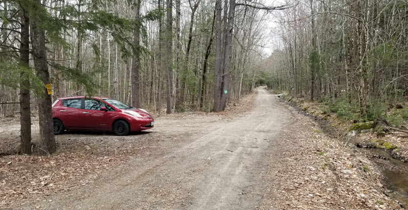
On Moody Road in May of 2024, the view back to the east. The Town-of-Porter snow plow turn-around is at the left. Further distant, the entrance to the FSHT Devils Den parking area is at the right.
At the start of Snake Road, you are in the middle of property of the La Finca Farming Cooperative. At the junction you will see sheds, a farmhouse, and greenhouses. You are welcome here, but please respect their property and do not interfere with their work. If you meet anybody, feel free to introduce yourself; they will be interested in where you are from and may want to share some details of their work.
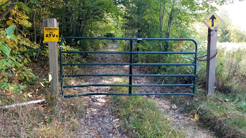
As you start up the Snake Road, there is a steel gate on wooden posts. You can just walk around the posts. At about 800 ft you will find a much more massive gate. It will not be locked; if you find it difficult to get around the posts, feel free to open the gate, but close it after you pass.
As you continue up the road, you will find many earthen water bars and deep ditches. Heavy storms have caused serious damage to our road, and the water bars are necessary to divert water out of the road and preserve the road. To get over these water bars, vehicles need fairly high clearance.
At about half-way up the road, you will see the crossing of the Devils Den Trail.
Continuing upward, the road gets steeper until it meets the ATV trail coming in from the left and emerges onto exposed, glaciated ledges, at the north end of our large clearing.
The Snake Road crosses the clearing, with a fork diverting to the cabin. We stop the road at about 150 ft from the ledges overlook. That last 150 ft is a revegetation area where we want native vegetation to redevelop and protect the stability of the soils near the ledges. This area is roped off with yellow polypropylene safety rope and designated by signage. There will always be two pathways through the revegetation area.
Devils Den ATV Trail
Note: At the present time the ATV Trail is considered to be CLOSED because we do not want ATVs or other motorized vehicles to be further damaging the trail and some steep sections are dangerous for vehicle use. However, there is no harm in walking the trail if you will be careful to avoid the dangers of steep places and deep mud-holes.
The Devils Den Trail actually starts on the historical Devils Den Road. This road starts at the intersection where Norton Hill Road turns north and Moody Road starts.
The Devils Den Road (DDR) is another unmaintained road, and it has suffered much damage from the use by many off-road vehicles. Heading south from the intersection, the DDR ascends for the first hundred yards, reaches a gentle height-of-land, then starts a steep descent. Like the ATV trail, there are places that are deep mud-holes and other places with loose rocks from severe erosion.
While descending, at a little more than a quarter mile from Norton Hill Road, the ATV trail departs to the right from the DDR, with the ATV trail ascending a steep, very eroded, rocky slope. Nearing the top of that slope there are steep, exposed ledges. The trail levels off in a grove of pines, bears to the left, then circles around the corner of a stone wall, crossing into our Devils Den property through an opening in that stone wall.
The trail turns westward, unfortunately developing into a series of deep mud-wallows, then it runs a short distance westward, parallel to the broad clearing at Devils Den. It then joins the Snake Road to finish the ascent to the ledges overlook.
Devils Den Loop Hikes
As you can see from the previous descriptions and the details in the trails map, there are several options to use the Devils Den Trail with the adjacent roads for loop trails that can add variety to your hiking. Enjoy the available options.
Devils Den to Bald Ledge
Moody Road has already been described as the road to use for access to Devils Den, but it is important to know that this road is NOT maintained by the town for all parts of the road that are west of the snow plow turn-around. The La Finca cooperative does use the road for the part that continues westward across their property, and FSHT will also continue to use it for maintenance work on our Moody Road South property.
Beyond the La Finca property, the Moody Road is not maintained, and parts of it are just as rough as most other unmaintained roads of this area. However, it is still frequently used by snowmobiles in winter and by off-road vehicles at other times. It can also be a good route for some extended hikes. From the Moody Road parking area for Devils Den to the Varney Road parking area for Bald Ledge is a distance of about 1.5 miles, including about 250 yards of Breakneck Hill Road to connect between Moody Road and Varney Road.
And, of course, all of the FSHT properties in the Porter Hills are open for exploring on foot (or snowshoes) for nature study, hunting, and other low-impact adventures.
Devils Den Connector
At the signed fork on the Devils Den trail, the Spur Trail continues about 500 ft and ends in “The Gateway,” an opening into a slope down into lands to the south and bounded on both sides by steep cliffs. As of August 2025, we have completed the work on a new trail that continues westward into our Moody Road South property. This trail visits two more viewpoint features and ends at another trail head on Moody Road. AllTrails Map
Ingalls Pond:
 A complex of interconnected shallow ponds, marshes, and swamp lands with ‘islands’ of forested land and many man-made features that have ‘reconstructed’ the ponds during centuries of use. Ingalls Pond is located almost entirely in Baldwin, Maine, and is bisected by the Pequawket Trail highway. The parking area is at latitude, longitude: 43.857861, -70.790080.
Directions:
From the South
Drive to West Baldwin on Pequawket Trail (State routes 5/113/117 through West Baldwin.). The West Baldwin Post Office is at 932 Pequawket Trail. From that Post Office, continue driving 2 miles north. As the highway descends to Ingalls Pond, the southernmost part of the pond will be on your left, and the small parking area is just a short distance ahead on the left. Beyond the parking area, you will also see a sign on the right for the P Y Estes Contractor Quarry.
From the North
Drive through Hiram on Pequawket Trail. From the Saco River bridge in Hiram, where State Route 117 (Main Street) joins with State Route 5/113, continue south. At about one mile from the bridge, you will cross the town line into West Baldwin and you will see parts of Ingalls Pond on both sides of the road. Continue for about a half mile; just after seeing the P Y Estes quarry sign on your left, you will see the small parking area on your right.
Trail Maps: Ingalls Pond Trail Map, AllTrails Map
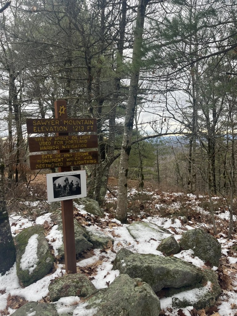
Sawyer Mountain Highlands:
The trailhead is located at a sharp turn in Route 117, 2.5 miles south of the junction of Routes 25 and 117, or 2.4 miles north of the junction of Routes 11 and 117.
There is a short Nature Trail just off the parking lot on Route 117, which includes several numbered education stations. The mountain is also accessible from the Limerick side, starting at the Sawyer Mountain Road, 1.1 miles north of Emery’s Corner.
Sawyer Mountain Trail Map (PDF), Sawyer Mountain Highlands on AllTrails, Sense of Place Nature Trail
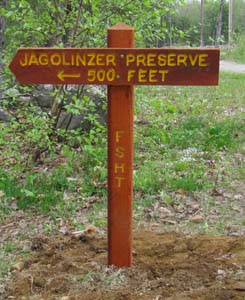
Jagolinzer Preserve:
The Jagolinzer Preserve is located in Limington, Maine on Route 25. A sign one-half mile west of the junction of Route 25 and 117 marks the start of the right-of-way to the nature area. The sign is located at the intersection of Route 25 and Olive’s Way.
To enter the preserve, walk 250 feet down the right-of-way on Olive’s Way, and then at the second sign angle to the left and walk an additional 500 feet. The loop takes approximately 45 minutes and passes Pease Brook, an old dam, the Saco River, and returns through the woods.
Heath Loop Trail:
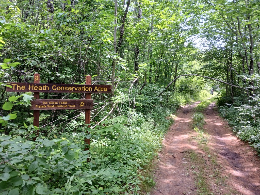
Head out on this 2.5-mile loop trail near Cornish, Maine. Generally considered an easy route, it takes an average of 51 minutes to complete. This trail is great for hiking, and it’s unlikely you’ll encounter many other people while exploring. The best times to visit this trail are April through November. Dogs are welcome but must be on a leash.
Immerse yourself in the tranquility of nature on the easy-going Heath Loop Trail, a charming walk maintained by the dedicated Francis Small Heritage Trust. This unique trail encircles “The Heath” (pronounced “Haith”), a beautiful wetland ecosystem brimming with at least seven rare plant species, made possible by the generous land donation from Tom and Edie Sisson.
Highlights and Unique Features:
Bog Bridge: Cross a sturdy bog bridge, a testament to community effort, constructed in 2013 as part of an Eagle Scout Project.
The Heath Road: Glimpse into the past along the path of The Heath Road, originally laid out in 1857 but discontinued in 1925, adding a historical layer to your stroll.
Ms. Cole’s Cellar Hole: Keep an eye out for Ms. Cole’s cellar hole. Legend has it she still serves freshly baked brownies to lucky passers-by – perhaps you’ll be one of them! In the summer months, her former home site is adorned with lovely daylilies.
Trail Details and Experience:
This easy loop offers a peaceful journey through varied woodland terrain as it circles the unique wetland. With no significant challenges, it’s an ideal trail for a casual outing for all ages. You can expect to complete the loop in approximately 2 hours. The trail is particularly delightful from late spring through fall, offering lush greenery in summer (perfect for spotting Ms. Cole’s daylilies!) and vibrant foliage as the leaves change.
